Arctic region - Contaminants aggregated datasets 1974/2015 v2018
Dataset extent
Map data © OpenStreetMap contributors
Tiles by MapBox
Tags
Data and Resources
To access the resources you must log in
-
Data Access and Citation
Data Access and Citation
The resource: 'Data Access and Citation' is not accessible as guest user. You must login to access it! -
Direct DownloadZIP
Direct Download
The resource: 'Direct Download' is not accessible as guest user. You must login to access it!
Geonetwork Links
Additional Info
| Field | Value |
|---|---|
| access_constraints | ["no limitations"] |
| bbox-east-long | 62.49 |
| bbox-north-lat | 88.2603 |
| bbox-south-lat | 59.99166 |
| bbox-west-long | -39.90192 |
| contact-email | folke.mehrtens@awi.de |
| coupled-resource | [] |
| dataset-reference-date | [{"type": "creation", "value": ""}] |
| graphic-preview-description | Water profiles |
| graphic-preview-file | 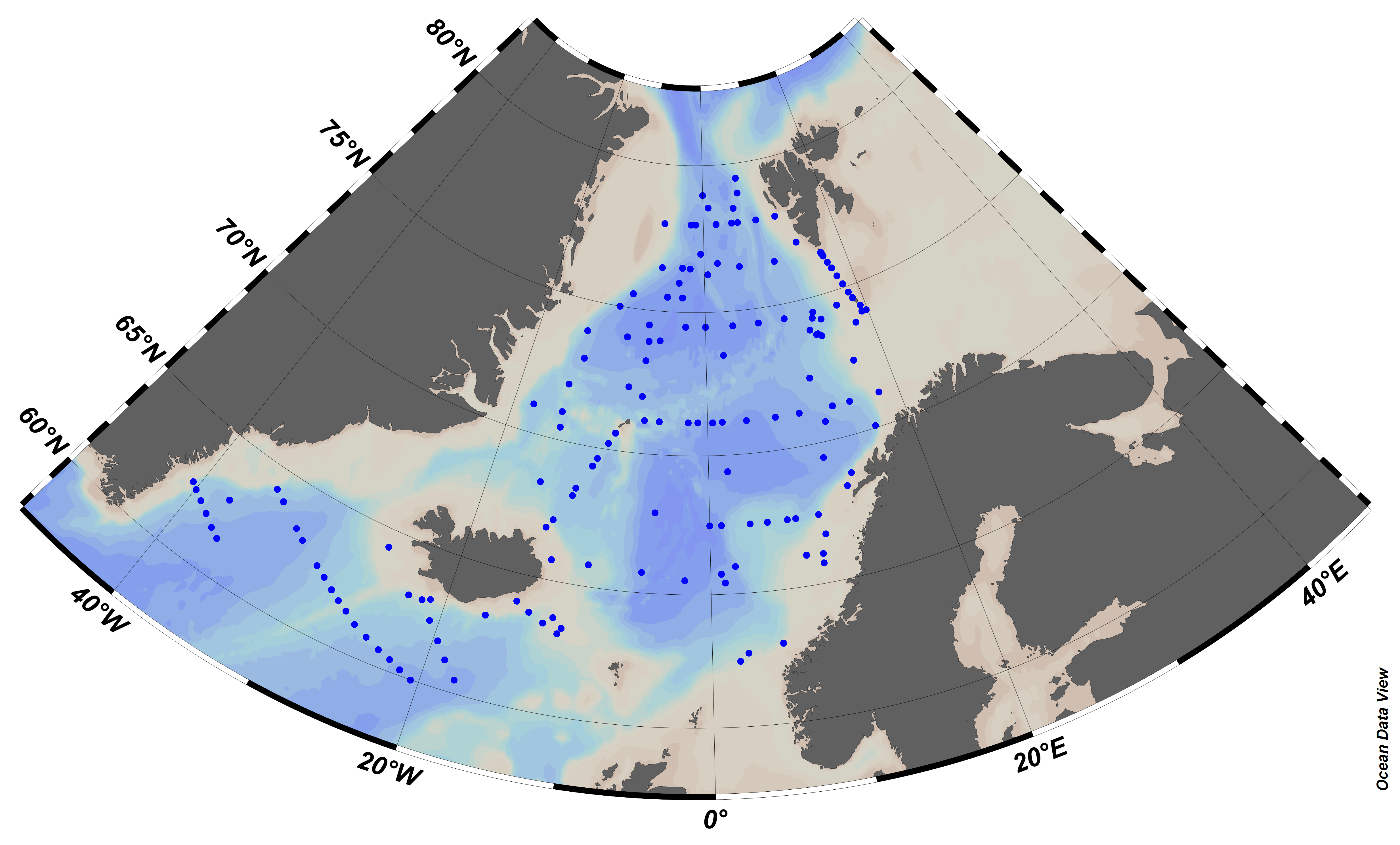 |
| GUID | b7673122-987d-4ab4-af7f-4e44239e64ec |
| licence | [] |
| metadata-date | 2019-05-03T11:22:52 |
| metadata-language | eng |
| point_of_contact 1 | folke.mehrtens@awi.de |
| point_of_contact 12 | postmottak@uit.no |
| point_of_contact 13 | nmd@imr.no |
| point_of_contact 2 | info@briese.de |
| point_of_contact 3 | posteingang@bsh.de |
| point_of_contact 4 | info@geomar.de |
| point_of_contact 5 | gin@ginras.ru |
| point_of_contact 6 | post@imr.no |
| point_of_contact 8 | leader@kolgimet.murman.ru |
| point_of_contact 9 | info@nsf.gov |
| resource-type | series |
| responsible-party | [{"name": "Leibniz Institute for Baltic Sea Research, Warnem\u00fcnde", "roles": ["originator"]}, {"name": "National Science Foundation (NSF)", "roles": ["originator"]}, {"name": "Briese Schiffahrt", "roles": ["originator"]}, {"name": "Alfred Wegener Institute Helmholtz Centre for Polar and Marine Research", "roles": ["originator"]}, {"name": "Odessa Branch of SOI (State Oceanographic Institute)", "roles": ["originator"]}, {"name": "University of Troms\u00f8", "roles": ["originator"]}, {"name": "Geological Institute, Russian Academy of Sciences", "roles": ["originator"]}, {"name": "U.S. Geological Survey", "roles": ["originator"]}, {"name": "Institute of Marine Research - Norwegian Marine Data Centre (NMD)", "roles": ["author"]}, {"name": "Institute of Marine Research", "roles": ["originator"]}, {"name": "Federal Maritime and Hydrographic Agency", "roles": ["originator"]}, {"name": "Murmansk Hydrometeorological Administration of Roshydromet", "roles": ["originator"]}, {"name": "GEOMAR Helmholtz Centre for Ocean Research Kiel", "roles": ["originator"]}] |
| spatial | {"type": "Polygon", "coordinates": [[[-39.90192, 59.99166], [62.49, 59.99166], [62.49, 88.2603], [-39.90192, 88.2603], [-39.90192, 59.99166]]]} |
| spatial-reference-system | WGS 84 (EPSG 4326) |
| spatial_harvester | true |
| system:type | Series |
| temporal-extent-begin | 2010-10-05 |
| topic_category | oceans, environment |
Management Info
| Field | Value |
|---|---|
| Author | EMODnet Chemistry |
| Maintainer | bluebridge_catalogue_one |
| Last Updated | 23 December 2019, 19:18 (CET) |
| Created | 23 December 2019, 19:18 (CET) |